
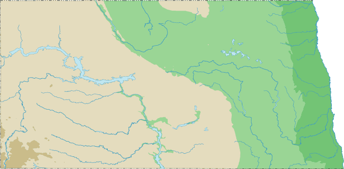
North Dakota Topographical Map
Static North Dakota Topo Map
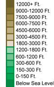
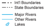
This section features a topographical map of North Dakota as well as a map legend that specifies elevation ranges and indicates their corresponding map colors.
Map Legend |
 |
|
 |
North Dakota Topographical Features
North Dakota's highest mountain is White Butte, whose peak is 3,506 feet above sea level. North Dakota's lowest elevation is 750 feet above sea level, at the Red River. North Dakota landforms include the Red River valley in the east, a Central Plateau, and the rugged, hilly Badlands in the west. Major rivers in North Dakota include the Red, Souris, Missouri, Little Missouri, and James.Interactive North Dakota Topo Map
This section features a topographical map that can be zoomed and panned to show the entire State of North Dakota or a small portion of the state. To zoom in or out on the map, use the plus (+) button or the minus (-) button, respectively. To pan the map in any direction, simply swipe it or drag it in that direction. At high zoom levels, the contour lines on this North Dakota map can help outdoorsmen, land developers, and others to plan their routes and activities more efficiently.
Copyright © 2005-2024 State-Maps.org. All rights reserved.
North-Dakota-Map.org is a State Maps reference source.
North-Dakota-Map.org is a State Maps reference source.